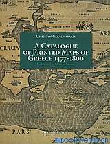
A Catalogue of Printed Maps of Greece 1477-1800
Εκδότης:
Adventure
Έτος:
2009
ISBN:
9789608779242
Σελίδες:
355
Εξώφυλλο:
Πανόδετο

Τιμή εκδότη:€152,16
Η τιμή μας: €136,94
A Catalogue of Printed Maps of Greece 1477-1800
Thirty five years have elapsed since my catalogue of printed maps of Greece and Greek regions from 1477 to 1800 was firstly published in the tenth and eleventh volumes of the London quarterly Map Collectors' 5eries in 1974. This catalogue, which included 707 entries and ten photographs of maps, was succeeded by an edition of 2173 entries and a relatively rich corpus illustratum, published in 1982 by the Leventis Foundation in Nicosia, Cyprus. The catalogue was honoured with an award from the Academy of Athens in 1984 for "its outstanding contribution to the promotion of the History of Geography" and was further revised and enlarged to 2538 entries with its second edition of 1992, issued by the 5amourkas Foundation in Athens, which also took care of the two addenda of 1998 and 2004.
Having concluded at that time that as far as Ι was personally concerned Ι had completed my "homework": Ι did not consider any eventuality for a renewed edition of the catalogue, only to be convinced to the opposite two years ago by sustained encouraging suggestions of many friends interested in cartography as well as by the findings of my own research which Ι never stopped albeit without intention to publish the relevant material.
The outcome of this change of mind is the present catalogue with its 3908 entries, its many corrections of errata and omissions of the previous editions and -what, Ι believe, is much more important and useful- its almost complete set of nearly 3000 photographs, covering a most extensive and representative part of the enlisted cartographic works.
As rich, though, as the new collected material may be, still this book would not have been possible in its present form without the collective effort of some dedicated cartographic researchers, scholars and collectors.
Ιn this context Ι would like, first and foremost, to express my gratitude to the "Sylvia Ioannou Foundation" and its Chairperson Mrs Sylvia Ioannou who graciously undertook the burden of this publication, thus confirming her profound interest in fields combining history, science and art.
Furthermore my deep appreciation and sincere thanks are addressed to Mrs. Artemis Scutari who carried out in a most impressive way the "Herculean" task of discovering, selecting and identifying thousands of photographs of maps, while at the same time coordinating the gathering of additional relevant information from several sources which expanded the list, specially with regard to the prolific variations of a multitude of maps. Her dedication, persistence and substantial co-authorial contribution all along have been really invaluable for the realisation of the whole project. [...]
Christos G. Zacharakis
Athens, May 2009
| Τίτλος βιβλίου: | A Catalogue of Printed Maps of Greece 1477-1800 | ||
|---|---|---|---|
| Εκδότης: | Adventure | ||
| Συντελεστές βιβλίου: | Ζαχαράκις, Χρήστος Γ. (Συγγραφέας) | ||
| ISBN: | 9789608779242 | Εξώφυλλο βιβλίου: | Πανόδετο |
| Στοιχεία έκδοσης: | Οκτώβριος 2009 | Διαστάσεις: | 34x27 |
| Κατηγορίες: | Επιστήμες > Θετικές > Αρχιτεκτονικη, Τοπογραφία, Χαρτογραφία | ||
Δεν βρέθηκαν στοιχεία για τον συγγραφέα


